

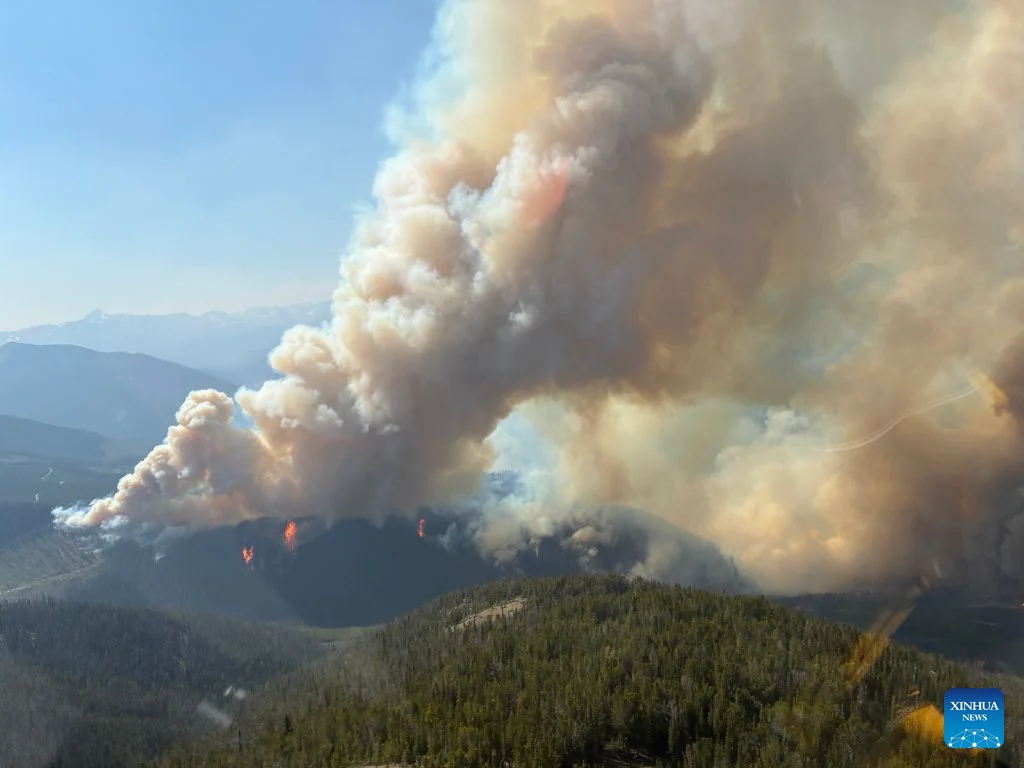
As France and Spain contend with some of their worst wildfires in years, scientists are warning of a phenomenon that could make things even more dangerous: pyrocumulonimbus clouds, commonly known as fire clouds.
Wildfires typically spread fastest when heat, wind and dry conditions combine, but sufficiently intense fires can go a step further and generate their own weather systems entirely. The most extreme version of this is the pyrocumulonimbus cloud, essentially a thunderstorm born directly out of a wildfire’s own smoke plume.
These clouds form when a massive fire releases enough heat and energy to send a smoke plume rising rapidly into the atmosphere. As that plume climbs, it hits lower atmospheric pressure, cools, and the moisture within it condenses into a cloud, one capable of producing lightning and strong winds.
When a fire is large and intense enough, that plume can tower 10 to 15 kilometers into the sky, punching through into the stratosphere. NASA has described the phenomenon as something like a fire-breathing dragon among clouds.
Read more about this topic: About 3,000 Portuguese residents live in the area hit by France’s Gironde wildfire. Temperatures near 40 degrees are expected this week
Rick McRae, an adjunct professor with the University of New South Wales’ bushfire research group, described it as essentially a full thunderstorm forming inside the fire’s own smoke column, one large enough to occupy roughly 10,000 cubic kilometers of atmosphere.
The danger lies in what these clouds do once they form. They can generate winds that accelerate the spread of the fire below and sometimes produce lightning capable of sparking entirely new fires some distance away. Experts say the resulting gusts make fire behavior far less predictable, putting ground crews battling the blaze at greater risk.
McRae, who spent three decades as a senior fire manager, said the appearance of such a cloud effectively confirms that a fire has become extremely dangerous and that large-scale evacuations are warranted.
Australia has been dealing with these fire clouds since the early 2000s, and researchers say they appear to be growing more frequent. They were also observed during California’s severe wildfires in 2022, but a similar event in France would mark new territory entirely.
Read more about this topic: How rescued firefighter donkeys are helping Spain prevent wildfires (with video)
If confirmed, it would be the first time a pyrocumulonimbus cloud has been documented in the country. McRae noted that whether one has already occurred in the past few days matters less than the more pressing question of whether one could form later this week, as forecasts point to renewed extreme heat arriving Tuesday or Wednesday.
The broader trend, according to McRae, ties directly back to the climate crisis, which is creating more dangerous wildfire conditions worldwide and, with them, more favorable conditions for these storm-generating clouds to form. He stressed that the shift isn’t as simple as rising temperatures alone, but reflects broader changes across the atmosphere and surface weather patterns, changes climate models suggest will only intensify going forward.
The fires currently burning across Europe have struck during peak tourist season, in a region already battered by repeated heatwaves and woodland left tinder-dry after months without significant rainfall since May.
Forecasters are now warning of another heatwave set to hit France starting Tuesday, with temperatures in some areas expected to reach 40C. McRae said a mass of extreme heat is expected to move westward from the direction of the Czech Republic over a four- to five-day stretch.