Início » 中國首次發布火星全球影像圖

中國首次發布火星全球影像圖

香港電台
Credit:國家航天局網站

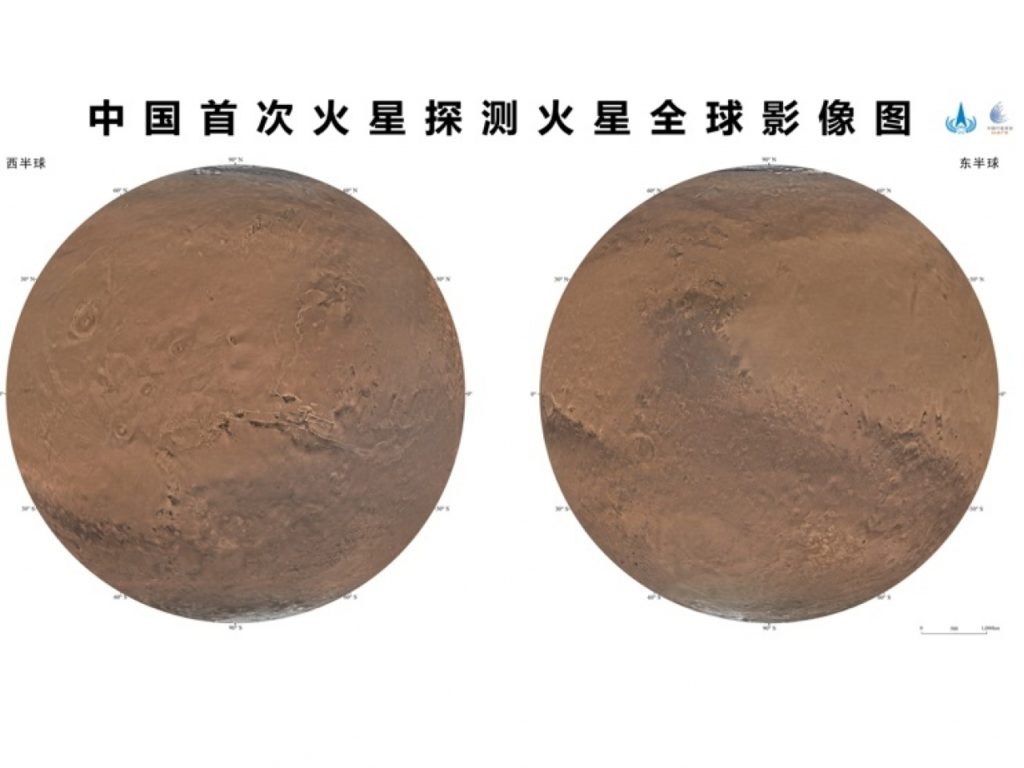
國家航天局和中國科學院聯合發布中國首次火星探測火星全球影像圖。

央視報道,今次發布的影像圖為彩色,由天問一號的中解析度相機,由2021年11月至2022年7月歷時8個月,進行284軌次遙感成像,對火星表面實現了全球覆蓋,並在地面應用系統對獲取的14757幅影像數據,進行處理後得到火星全球彩色影像圖。

科學研究團隊通過火星高分影像,識別著陸點附近大量的地理實體,國際天文聯合會根據相關規則,將其中的22個地理實體,以中國人口數目少於10萬的歷史文化名村名鎮命名,將中國標識永久刻印在火星大地。

聯絡我們

平台媒體,聚焦中葡關係。

平台編輯部

關於我們

電子報

訂閱平台電子報,縱觀全球新聞

© 2025 – Copyright Plataforma Media.

Uh-oh! It looks like you're using an ad blocker.

Our website relies on ads to provide free content and sustain our operations. By turning off your ad blocker, you help support us and ensure we can continue offering valuable content without any cost to you.

We truly appreciate your understanding and support. Thank you for considering disabling your ad blocker for this website